surveying
7 designs
Showing 7 of 7 (7 total)
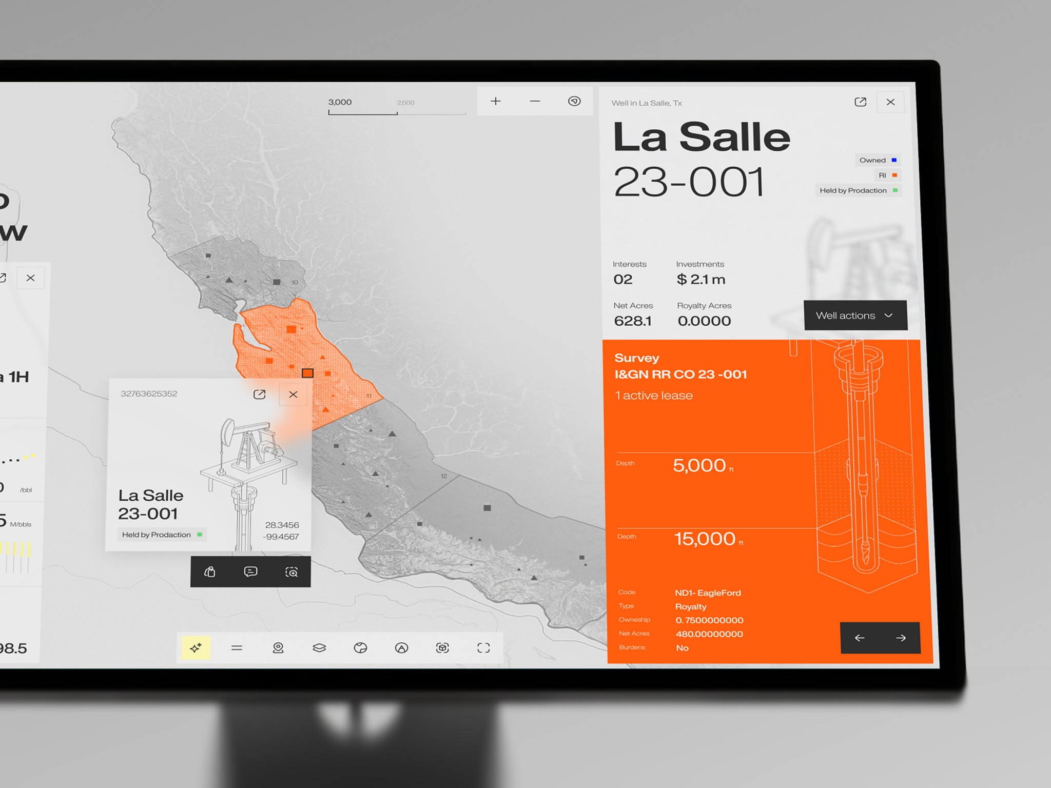
The design is highly functional, prioritizing the clear presentation of geospatial data through a clean, high-contrast interface. The visual language relies on strong segmentation between the map context and detailed numerical information, creating an analytical and professional feel.
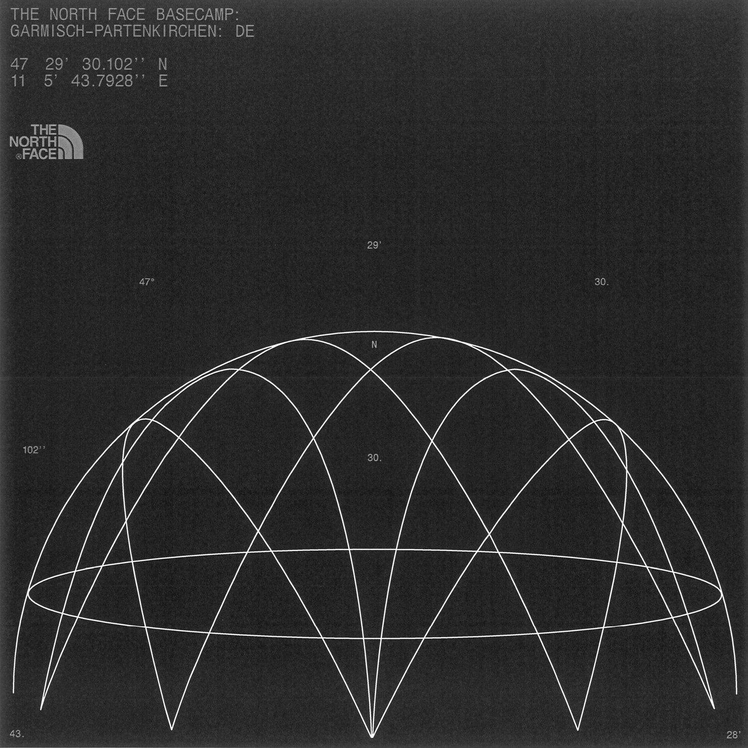
This image is a technical diagram, likely related to geographic or astronomical positioning, featuring a network of intersecting lines overlaid on a partial spherical projection. The visual language is stark, precise, and analytical, emphasizing geometric relationships over aesthetic embellishment.

A minimalist logo combining geometric abstraction with contemporary typography, featuring a stylized tripod or surveying instrument in blue paired with bold sans-serif lettering. The design balances technical precision with modern simplicity, creating a professional yet approachable visual identity.
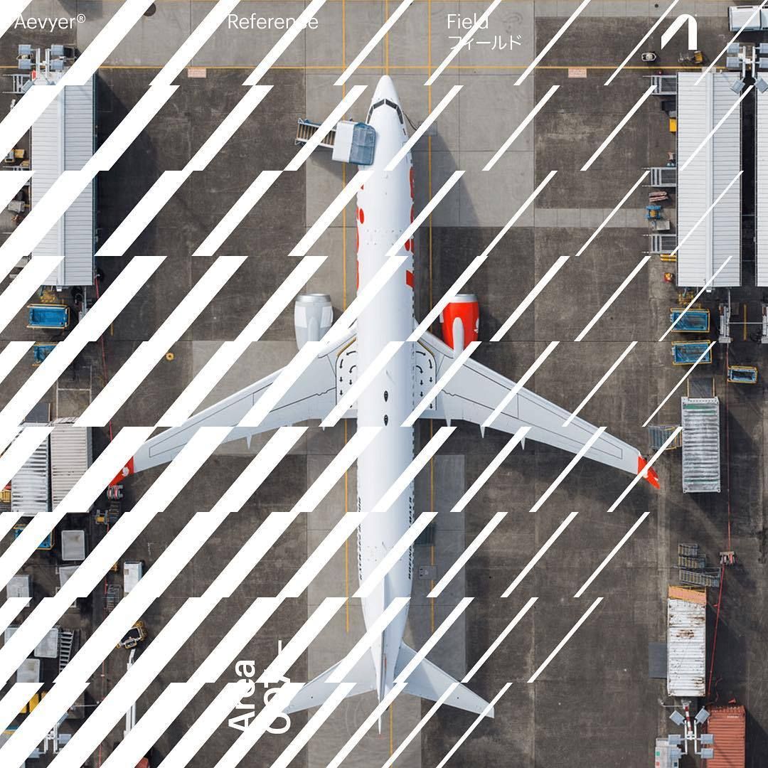
This image is an aerial or top-down view of an aircraft, likely a military or transport plane, set against a flat, industrial ground surface. The visual language is stark and technical, emphasizing the geometry of the aircraft against the muted tones of the environment.
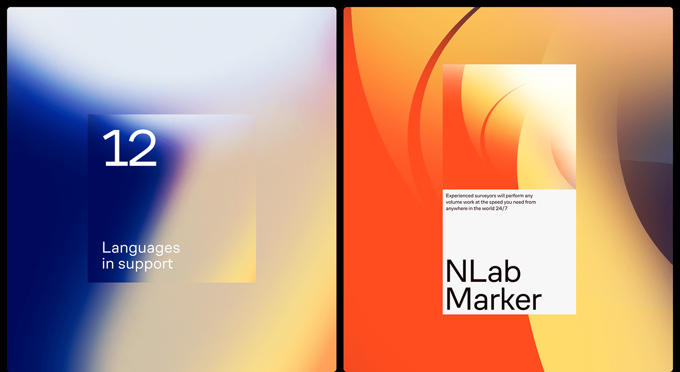
This visual utilizes a striking split composition featuring contrasting color gradients—cool blues on the left and warm oranges on the right—to create visual dynamism. The design employs soft transitions and clean typography to convey a professional, modern, and trustworthy atmosphere suitable for technical services.
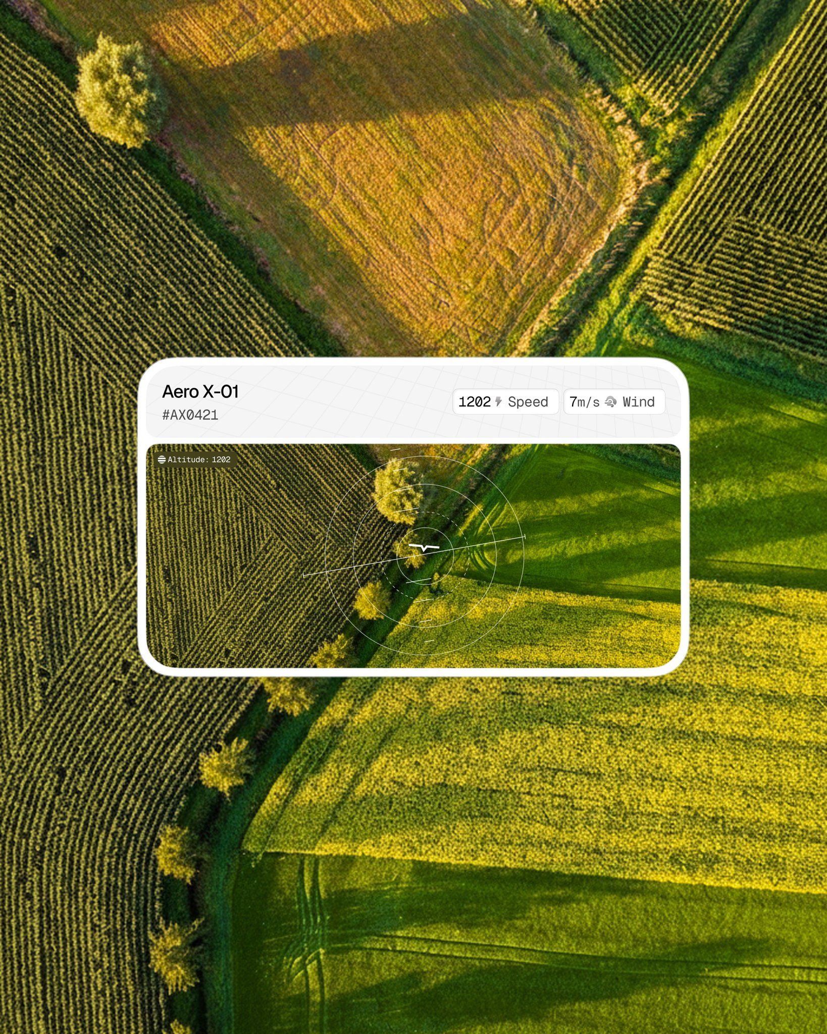
This image blends high-resolution agricultural photography with minimalist technical user interface elements, creating a sense of precise remote sensing and expansive natural beauty. The visual language is dominated by the contrast between organic textures and crisp, analytical overlays that highlight data collection.
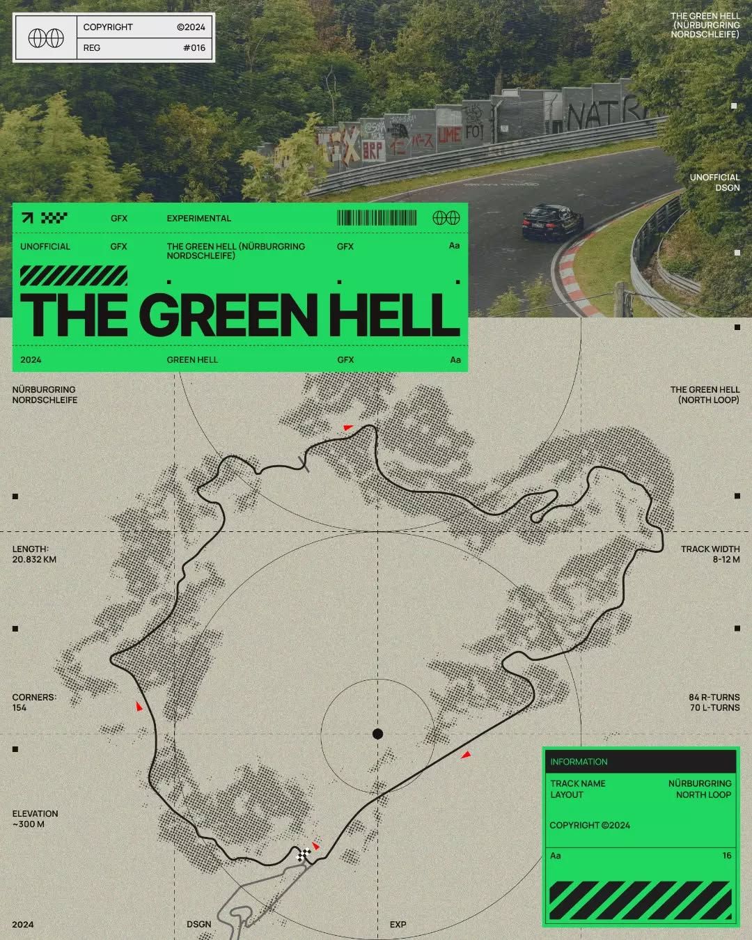
This is a technical schematic map detailing a specific outdoor layout, likely for a race track or challenging course. The design prioritizes clear spatial information and precise measurements, employing a minimalist yet highly functional visual language common in surveying or motorsport planning.